 |
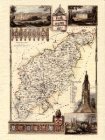
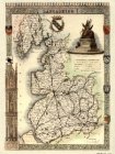
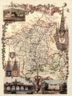
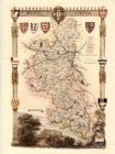
Northamptonshire
Maps
£ 9.00
20x16
Size: 20x16
Code: 201650
[ enlarge ]
|
|
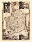 |
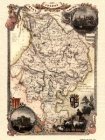
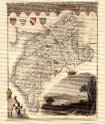
Mamouthshire
Maps
£ 9.00
20x16
Size: 20x16
Code: 201651
[ enlarge ]
|
|
|
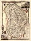 |
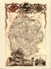
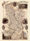
Lincolnshire
Maps
£ 9.00
20x16
Size: 20x16
Code: 201652
[ enlarge ]
|
|
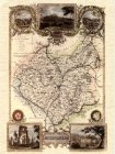 |
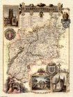
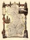
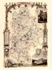
Leicestershire
Maps
£ 9.00
20x16
Size: 20x16
Code: 201653
[ enlarge ]
|
|
|
 |
Lancshire
Maps
£ 9.00
20x16
Size: 20x16
Code: 201654
[ enlarge ]
|
|
 |
Huntingdonshire
Maps
£ 9.00
20x16
Size: 20x16
Code: 201655
[ enlarge ]
|
|
|
 |
Herefordshire
Maps
£ 9.00
20x16
Size: 20x16
Code: 201656
[ enlarge ]
|
|
 |
Gloucestershire
Maps
£ 9.00
20x16
Size: 20x16
Code: 201657
[ enlarge ]
|
|
|
 |
Worcestershire
Maps
£ 9.00
20x16
Size: 20x16
Code: 201658
[ enlarge ]
|
|
 |
Sunderland
Maps
£ 9.00
20x16
Size: 20x16
Code: 201659
[ enlarge ]
|
|
|
 |
Derbyshire
Maps
£ 9.00
20x16
Size: 20x16
Code: 201660
[ enlarge ]
|
|
 |
Cambridgeshire
Maps
£ 9.00
20x16
Size: 20x16
Code: 201661
[ enlarge ]
|
|
|
 |
Barking Hampshire
Maps
£ 9.00
20x16
Size: 20x16
Code: 201662
[ enlarge ]
|
|
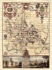 |
Oxford University
Maps
£ 9.00
20x16
Size: 20x16
Code: 201663
[ enlarge ]
|
|
|
 |
Bedfordshire
Maps
£ 9.00
20x16
Size: 20x16
Code: 201664
[ enlarge ]
|
|